3 p.m. Traffic Footage – Friday
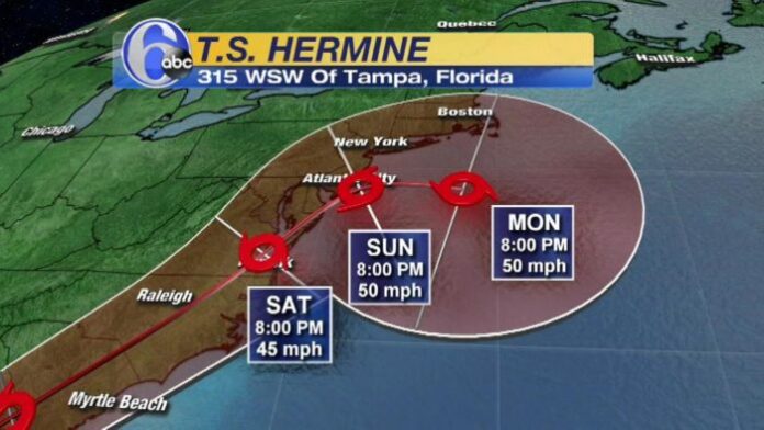
The city of North Myrtle Beach put out an alert for all tourists and residents of the greater Myrtle Beach area concerning Tropical Storm Hermine.
The tropical storm warning release states the following expected impacts:
Potential impacts:
- Potential wind gusts up to 55 mph, could be higher locally
- 5-7 inches likely with locally higher amounts possible.
- 1 to 2 ft. storm surge.
- There is a high confidence for marine impact along our coast Friday
- Tropical Force winds
- Isolated Tornadoes (Slight Risk Friday Afternoon & Overnight)
“A full moon Friday prompting king tides means flooded roads in low-lying coastal areas and rainfall is expected to overwhelm drainage systems in some areas,” said Steven Pfaff with the National Weather Service. “Wind gusts are expected to peak with 50 to 55 mph gusts between 2 p.m. and 4 p.m. in Georgetown County then a couple hours after that for Horry County,” Pfaff said.
“The path of Hermine continues to be across coastal Carolinas,” the National Weather Service said. “The wind field is expected to expand as the storm moves through with gusty winds likely to affect a large portion of northeast S.C. and southeast N.C.”
Conditions should improve quickly Saturday morning after sunrise.
As the worst conditions are expected today, stay tuned to this very page on MyrtleBeachSC.com. We will be adding video footage of Tropical Storm Hermine as the storm moves along the South Carolina coast.


